CROSS COUNTRY SKIING
Infinite Cross Country Skiing...
|
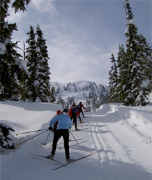
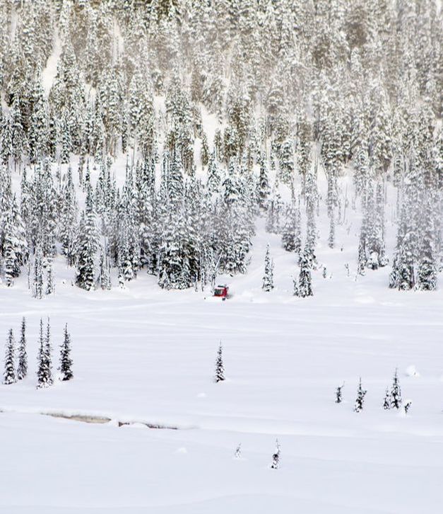
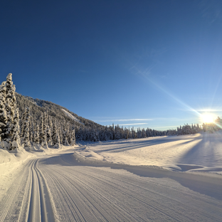
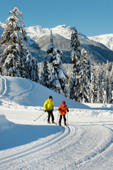
With over 120km of trails (30 kms dog-friendly) set on a 7,000 hectare landscape, Callaghan Valley Nordic offers something for everyone. Whether you choose to skate, classic ski, snowshoe or ski tour, the Alexander Falls Ski Touring Centre (first entrance to Callaghan Valley Nordic) offers a welcoming and affordable place to start your day’s adventure. The convenience of a Callaghan Valley Nordic day trail ticket provides access to the trails system of both Callaghan Country Wilderness and Whistler Olympic Park ski areas as one big ski area!
View Online Trail map PDF of Callaghan Valley Nordic Nordic Trail System
View Current Grooming Conditions |
Nordic Season Passes at Callaghan Valley Nordic
Callaghan Valley Nordic Season Passes offer the best value for Callaghan Valley Nordic fans who seek all access, from opening day in November to season end in April. Enjoy the flexibility to ski or snowshoe as little or as much as you like along with the bonus of great pass perks. A great winter commitment to get the family enjoying time in the outdoors. Don't forget to bring the dog to enjoy our plentiful dog-friendly cross country ski and snowshoe trails! *Our 100-day Snow Guarantee backs all Callaghan Valley Nordic passes, plus pass holders receive exclusive perks to use during the winter 2023/24 season, delivering even more value! Please call 604.964.0059 for more details about our Season Passes. This season we are pleased to offer a variety of Season Pass Products: Callaghan Valley Nordic , Weekday Passes, Dog Passes, Callaghan and Whistler Nordic Pass (aka Dual Area), Spirit Passes + Pass Perks!
|
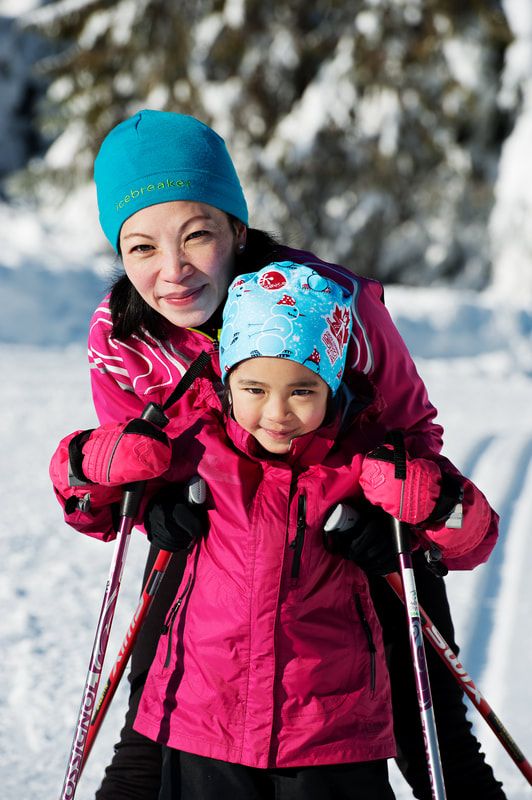
Family Skiing
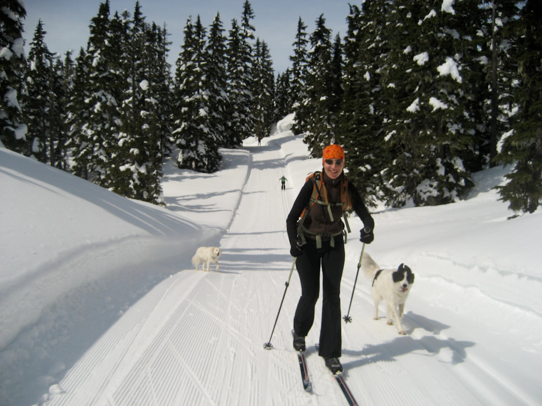
Access Callaghan Ski Shop provides a full line of reasonably priced ski and snowshoe equipment for daily rental. We also offer child-style chariots (sled pulks) for rent at competitive pricing. Start and finish your day without stress of a major hill climb back to your vehicle. Dog-Friendly Skiing Cross country skiers and their dogs have access to over 30kms of dog-friendly trails! All accessible from the Alexander Falls Ski Touring Centre. Come see what all the fuss is about. It's the BIGGEST off-leash trail network in the Sea to Sky. Classic Skiing Callaghan Country Wilderness grooms and track sets all of its trails to accommodate the traditional form of kick and glide skiing. The technique is recommended for entry-level skiers wishing to access the valley’s higher elevation trails. All equipment including “kick” skins are available at our Access Callaghan Ski Shop. Overnight Ski Packages No trip to Callaghan Valley is complete without a visit to Journeyman Lodge, the birthplace of the valley’s legendary skiing. Click here >> Journeyman Lodge Callaghan Lake Snowshuttle Are you looking to access so of the high country nordic skiing that Callaghan is famous for but wanting to skip the 8km climb up Mainline to Lake? Well we have the solution! The Callaghan Lake Snowshuttle takes guests in our new 15 passenger snowcat on shuttles twice daily up to the lake. Once up at the lake you can choose to even add a lunch to your experience while you enjoy the high country views. For More information and to book click here. Expert Cross Country Skiing Nestled into the vast landscape of Callaghan Country is the home of North America’s longest continuous Nordic hill climb and one of the world’s steepest descents. Athletes of all stripes come here to challenge themselves and cross train on some of the toughest terrain to be found anywhere. Can you rise to the challenge? Social Cross Country Ski Events at Callaghan Country's Alexander Falls Touring Centre We're proud to host several fun and accessible events throughout the season: visits from Santa, Outdoor Safety Day, and a fireside Speaker Series - to name a few. Callaghan Country is also home to the annual Benchmark Series, a Signature Social Ski Event designed to promote friendship, fitness, and a reconnection to the natural world. It's the playful side of Nordic.
|